 Text Mode
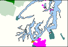
This map layer portrays the federally and Indian administered lands of the
United States that have any area equal to or greater than 640 acres. The
government agencies that administer these lands include the Bureau of
Indian Affairs, the Bureau
of Reclamation, the Bureau of
Land Management, the Department of Defense, the Forest Service, the Fish and Wildlife Service, the National Park Service, and the Tennessee Valley Authority.
This map layer was produced
by the U.S. Geological Survey.
It does not include linear (long, relatively narrow) features. Linear features
are available in a separate map layer that portrays the locations of parkways and scenic
rivers. This Federal and Indian Lands map layer also does not include any
federally and Indian held land that has an areal extent smaller than 640 acres
(though a separate map layer for these lands is in the works).
Download
this map layer in Shapefile format.
Download
this map layer in SDTS format.
Metadata
What follows is very detailed technical
information about this map layer. This is often called metadata. Metadata (or
"data about data") describe the content, quality, condition, and other
characteristics of data. Metadata are used to organize and maintain investments
in data, to provide information to data catalogs and clearinghouses, and to aid
data transfers. The Federal Geographic Data
Committee (FGDC) publishes the Content Standard for Digital
Geospatial Metadata. Many organizations within and outside of the federal
government have adopted the FGDC metadata standard and are using automated
indexing and serving mechanisms to provide access to their holdings through the
Internet. Visit the FGDC
Clearinghouse to learn more about how metadata is used in clearinghouses and
to search for other data sets.
1) Headwaters Forest Reserve, California (Bureau of Land Management)
2) Tall Grass Prairie National Preserve, Kansas (National Park Service)
3) Opal Creek Wilderness, Oregon (Forest Service)
4) Dugger Mountain Wilderness, Alabama (Forest Service)
5) Otay Mountain Wilderness, California (Bureau of Land Management)
6) Gunnison Gorge Wilderness, Colorado (Bureau of Land Management)
7) Black Canyon of the Gunnison National Park, Colorado (National
   Park Service)-formerly Black Canyon of the Gunnison National
   Monument
8) Agua Fria National Monument, California (Bureau of Land Management)
9) California Coastal National Monument, California (Bureau of Land
   Management)
10) Sequoia National Monument, California (Forest Service)
11) Canyons of the Ancients National Monument, Colorado (Bureau of Land
    Management)
12) Grand Canyon-Parashant National Monument, Arizona (Bureau of Land
    Management)
13) Ironwood Forest National Monument, Arizona (Bureau of Land
    Management)
14) Cascade-Siskiyou National Monument, Oregon (Bureau of Land
    Management)
15) Gunnison Gorge National Conservation Area, Colorado (Bureau of Land
    Management)
16) Silvio O. Conte National Wildlife Refuge, Vermont (Fish and
    Wildlife Service)
Data sets were obtained from the State, regional, or field offices
of the federal agencies which own or administer the newly created lands.
The data were re-projected, generalized, and integrated into the
existing federal lands data set. Hanford Reach National Monument,
Washington (Fish and Wildlife Service) and the expansion of Pinnacles
National Monument (National Park Service) are not included in this
release. The California Coastal National Monument consists of thousands
of Bureau of Land Management-administered islands, rocks, exposed reefs,
and pinnacles above high mean tide, within twelve nautical miles of the
shoreline, between Oregon and Mexico. The National Monument is shown in
the Federal Lands data set as a polygon which encloses this area.
All National Park Service lands in the existing Federal Lands data set were reviewed using a national boundary coverage, NPS-BND99. Some adjustments were made to resolve discrepancies between National Park Service data and existing National Atlas boundary data.
An inventory of all wilderness areas was conducted in cooperation with the Aldo Leopold Wilderness Research Institute. Wildernesses that were missing and that were larger than the minimum map resolution of 640 acres were acquired from the State, regional, or field offices of the land-owning agencies. The data sets were re-projected, generalized, and integrated into the existing Federal Lands data set. Newly established wilderness areas were also acquired and integrated into the data set. Eighty-six wilderness areas were added as a result of this effort.
The accuracy of wilderness names was reviewed in cooperation with the Aldo Leopold Wilderness Research Institute. Name changes were made to resolve misspellings or incorrectly named features.
Wilderness area boundaries in Arizona, California, New Mexico, and Colorado were reviewed and, in some cases, re-aligned. Arizona wilderness areas and wilderness study areas managed by the Bureau of Land Management (BLM), the Fish and Wildlife Service, the Forest Service, and National Park Service were reviewed with AZ-WLD90. California wilderness areas managed by the BLM were reviewed using Information the Sacramento office. Colorado wildernesses and wilderness study areas were reviewed with CO-WLD00 and CO-WSA00, respectively. New Mexico wilderness areas were reviewed with NM-WLD97, which includes wilderness areas managed by the BLM, Fish and Wildlife Service, the Forest Service, and the National Park Service.
An inventory of National Wildlife Refuges was conducted to ensure completeness of refuge data. Fifteen new refuges were added using data sets from regional or field offices of the Fish and Wildlife Service. Five additional refuges that meet the minimum mapping resolution of 640 acres could not be included because data were not available.
Military installations were reviewed with respect to base closure data provided by the Department of Defense Environmental Cleanup Office on their website (<http://www.dtic.mil/envirodod/>). Installations that have closed or are scheduled to close have a notation after the installation name; for example: Loring Air Force Base (Closed); Kelly Air Force Base (Scheduled to close).
Several Army Corps of Engineer lakes were reviewed with 1:100,000 scale topographic maps. Approximately 70 shorelines were adjusted.
In 1998, the National Atlas of the United States published a 1:7,500,00 scale map of Federal and Indian Lands. Corrections made in the preparation of this map were incorporated into the Federal Lands polygon data set. Approximately 60 corrections were made. They included name changes, spelling corrections, and addition and deletion of lands.
Several lands were deleted that were incorrectly attributed as Wilderness Study Areas. They are: Book Cliffs Instant Study Area, Utah; Devils Garden Natural Area, California; Blue Range Primitive Area, Arizona; and Joshua Tree National Landmark, Utah.
The two Veterans Administration Hospitals that had been included in the data were deleted. Although they had met the minimum mapping resolution of 640 acres, they were not the largest Veterans Administration in terms of capacity (number of beds). A determination will be made whether or not to include Veterans Administration hospitals prior to the next release of the data.
Digital Line Graph data that had not been complete at the time of the first release were incorporated into the data set.
The attributes were reorganized to better represent multi-coded features. In general, polygons which represent two or more feature classes, where one feature class is contained in another (e.g. a wilderness area inside a forest), have the smaller or 'contained' feature as Feature1 and the larger feature as Feature2. Similarly, the feature referenced as Feature3 will contain the land in Feature2.
Approximately 500 new URL addresses were added to link Federal Land features to agency websites.
1) Agricultural Research Service
2) Bureau of Prisons
3) Central Intelligence Agency
4) Department of Energy
5) Department of Transportation
6) General Services Administration
7) Metropolitan Washington Airports Authority
8) National Aeronautics and Space Administration
9) U.S. Coast Guard
10) U.S. Department of Agriculture